
Union County Street Directory Trail
A Union County street search works best as an ordered record trail. Start with the full situs address, which is the parcel's physical location, and identify its municipality before using an ownership source. The county Board of Taxation points users to municipal assessor and property-search routes, while the statewide Property Explorer can narrow a parcel by address, county, municipality, block, or lot. Write down the returned block and lot as well as the owner or taxpayer name when that field is visible. That creates a stable bridge to the County Clerk's name-indexed land records.
The Clerk index does not document a countywide address-only deed search. Its help page says online land records are indexed by name. That limitation matters on a long road with many parcels: move from the address to the parcel or owner first, then run grantor and grantee searches. A directory entry or a voter record can add a dated address clue, but neither replaces a recorded instrument or proves title.
- Normalize the address with municipality, street number, name, suffix, direction, unit, and ZIP. Check the parcel's situs address rather than copying a tax-notice mailing address.
- Use New Jersey Property Explorer or the municipal route linked by the Union County Board of Taxation to obtain the parcel's block and lot.
- Search the owner as grantee in the Union County Clerk UCPA index, open the latest published deed image when available, and note its prior reference.
- Search the named parties backward as grantor and grantee. Use book and page or instrument mode to confirm a link in the chain.
- Use the state voter-status route only for its stated registration purpose, then compare dated local directories or newspapers for historical household evidence.
Note: Keep owner, taxpayer, recorded party, and directory household in separate columns because the records answer different questions.
Union County Street Directory Coverage
Several Union County sources are keyed to an address, parcel, or name connected to a street. The parcel layer is the place to orient the address and capture identifiers. The Clerk holds real-estate ownership and transfer documents in the Record Room, and its public computer terminals cover deeds, mortgages, liens, and related instruments. Voter information is a narrower civic-record channel with protected-person and status limits. Local directory and newspaper collections provide dated historical entries, not a present-day roll.
| Address record | Union County keeper | Street-level value | Documented access |
|---|---|---|---|
| Parcel and assessment record | Municipal assessor / Board gateway | Situs, block, lot, assessment fields, taxpayer or owner where shown | County gateway and municipal route |
| State parcel layer | NJ Property Explorer and NJGIN | Address, location, block/lot, assessment and tax context | State web tools and data services |
| Recorded land instrument | Union County Clerk | Grantor, grantee, instrument details, prior references | UCPA index, Record Room, certified-copy request |
| Registration information | NJ Division of Elections / County BOE | A lawful, dated civic-record lead with privacy exclusions | State Voter Search and BOE contact route |
| Directory or newspaper entry | Union and Plainfield public libraries | Publication-date household or street evidence | Digitized collections and local-history shelves |
The same street name does not make records interchangeable. A block-and-lot identifies a parcel, while an instrument identifies a filing and its parties. A directory can show a person at an address in a particular edition. The Clerk's Record Room information is the fallback for records and images the online system does not supply.
Union County Address Normalization
Before comparing results, record the municipality separately from the postal city. Union County postal labels, municipal limits, tax jurisdiction, and parcel geography do not always align. The research file also cautions that a parcel mailing address can be outside the subject municipality or state. It is a tax-notice destination, not proof that the parcel is there. Preserve the source date and the source's spelling, then try alternate forms only as search variants.
- Parcel
- A defined piece of land in the tax or mapping system, commonly tied to a block and lot. It is a useful search key, not a statement about who occupies it.
- Situs address
- The physical location of the parcel. It should be kept apart from the taxpayer's mailing address.
- Plat
- A recorded map or plan used to describe land. Parcel polygons shown online are not automatically a legal plat or survey.
- Criss-cross directory
- A reverse-style directory arranged from address or street toward names, when a collection includes that arrangement.
Plainfield's local-history blueprint guidance supplies a useful Union County search quirk. It says to omit “Street” or “Avenue,” omit directional prefixes, and try full names plus abbreviations for numbered streets. That is a search technique for its historic blueprint work, not a claim about every county portal. It can still help when a historic index rejects a modern-looking address string.
Union County Property Explorer Fields
The state Property Explorer is the documented statewide parcel fallback for Union County. It is especially helpful when an address needs to be translated into county, municipality, block, and lot. The state says the display can include location or owner where not redacted, assessed land and building values, prior-year taxes, and classification. Local assessors file the annual list with the county board in January, so a later deed or change can post after the annual file.
| Documented field or mode | Use for a street search | Research limit |
|---|---|---|
| Address | Find a parcel by street address | Static source does not state requiredness |
| County | Choose Union County | Selector options were not captured |
| Municipality | Separate the legal municipality from a postal label | Selector options were not captured |
| Block and lot | Locate the parcel after an address or map result | Format requirements were not stated |
| Map or parcel interaction | Orient the street and inspect a parcel display | Live control labels were not captured |
No current Union-specific dynamic assessor field list was captured. That is why this street directory does not promise an assessor owner-name filter, a ZIP filter, exports, or a street-wide result list that the official material does not document.
Union County Parcel Map Limits
The NJGIN parcel resource combines county parcel data under statewide standards and can help orient an address on a road or identify nearby block-and-lot references. Its own warning is important: parcel polygons are not legal boundaries or surveys, adjacent-county edges may not align, and the county data steward is the current source. Daniel's Law protections can also remove owner names from hosted downloads, map services, and applications.
The official state parcel resource is shown below before using a map result as a lead for the appropriate municipal or Clerk record.
New Jersey Property Explorer provides the address, county, municipality, block, and lot approach documented for statewide parcel searching.
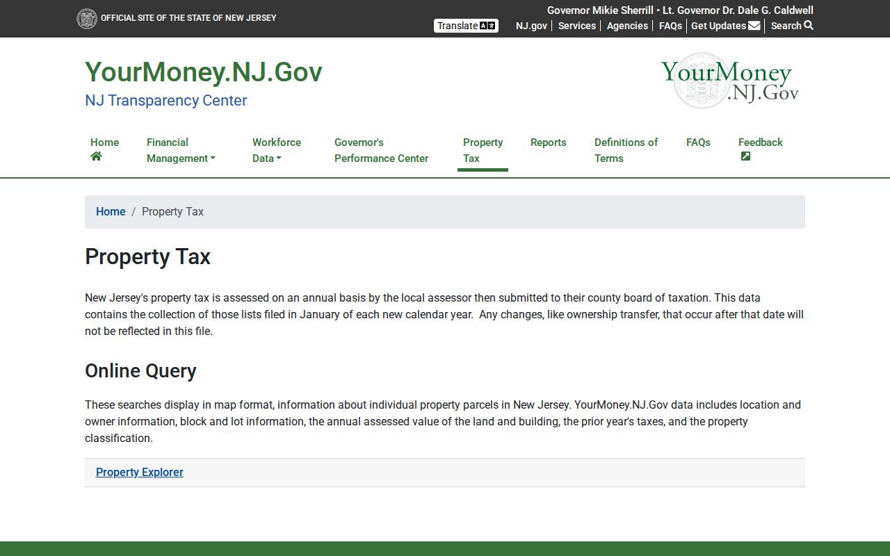
A Union County street directory search should use the displayed parcel details to form a precise record query, then check the municipal or County Clerk source for the underlying current record.
Union County Deed Names by Street
The County Clerk's UCPA system is the recorded-title step after the address has produced an owner or party name. Its search help documents last name, optional first name, matching choices, party type, document type, date range, and results-per-page for name searches. It also documents book-and-page, instrument-number, and date-range modes. Name/date searches require dates, and the date-range mode has a 31-day maximum.
Online coverage displayed during the research ran from June 1, 1977 through August 24, 2026. The Record Room holds land transactions from 1857 to the present. Pre-1977 transactions are in book form, and imaging for records before January 1986 is ongoing. For an older link, visit the Elizabeth counter and ask for the grantor and grantee indexes instead of assuming the instrument image will appear online.
The Clerk's search-help interface is the source for the name, book/page, instrument, and date modes used to verify a parcel-to-deed trail.
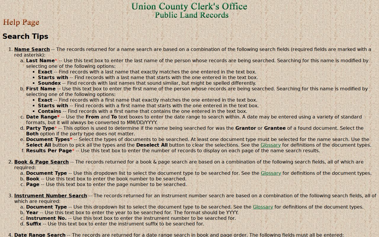
This screen reflects the Clerk's documented name-oriented search choices. It does not turn a street address into a universal deed-index field.
Certified copies use the Clerk's document request route. It asks for an instrument number, document type, recording date, book and page when known, name, page count, copies, and certification choice. Visa and Mastercard are listed, and the site says copies are mailed through USPS in three to five days. Verify the current document-specific charge because the captured request page did not print the fee schedule.
Union County Street Directory Eras
Union County's address trail changes by era. The online UCPA index begins in 1977, while Clerk land holdings reach to the county's 1857 creation. The statewide annual assessment file has its own certification timing, and directory entries are tied to publication dates. A current parcel display, an older recorded deed, and a library directory can therefore all be accurate while describing different moments. The strongest comparison is not online versus paper. It is parcel context versus title evidence versus dated household evidence.
| Period | Best initial street record | What to expect |
|---|---|---|
| 1857 to 1976 | Elizabeth Record Room grantor/grantee books | Staff help, book indexes, and possible image gaps |
| 1977 to before 1986 | UCPA name index plus Record Room | Online index with older imaging still incomplete |
| 1986 to present | UCPA, property tools, municipal assessor | More published images, subject to redactions and status |
That paper-to-web divide is why a name miss in the web index is not proof that a Union County parcel has no earlier deed history.
Union County Voter Street Records
New Jersey voter registration information links the Voter Search for registration status. The research did not capture the direct form's live fields, buttons, or result columns. It should therefore be used for its stated status purpose, not presented as a street-wide resident roster. The statute describes public voter-list fields such as name, address, date of birth, party affiliation, and voting history, while signatures and protected-person addresses are excluded or handled differently.
For list questions, corrections, or election forms, contact the Union County Board of Elections at its documented county route. An inactive status can mean an address confirmation issue, not a conclusion that someone left the county. Keep voter material dated and separate from a parcel owner or a directory household.
Union County Street Directory Clues
Historic street evidence is strongest when it is dated and compared across editions. Union Public Library's Digifind collection lists city directories from 1942 to 2012, although one library database description gives 1952 as the start. Treat that discrepancy as a reason to verify the live catalog, not as a basis for choosing a year by assumption. Plainfield Public Library adds directories, maps, blueprints, newspapers, and a house-history method to the local fallback chain.
A street index or criss-cross volume may reveal a household line for an edition year. It does not establish legal ownership. If the aim shifts from a named road to verifying one person across records, use the separate Union County resident lookup route rather than stretching a street result beyond its source.
Note: Copy the publication year with every directory entry because a street listing is historical evidence, not a current occupancy statement.
Union County Street Records Access
Online tools are only part of the Union County street directory process. The County Clerk's main office is at 2 Broad Street in Elizabeth, with recording hours listed as Monday through Friday, 8:30 a.m. to 4:30 p.m., and a recording counter that closes at 3:30 p.m. The Westfield satellite handles selected Clerk services, but the research does not describe it as a substitute land-record counter. Call the Clerk at 908-527-4787 before an older-book visit.
Use municipal assessors and collectors for tax-record corrections, Property Explorer and NJGIN for statewide parcel context, the Record Room for pre-1977 books or staff-assisted searches, libraries for historic materials, and the New Jersey State Archives genealogy collections for older supporting records. For a non-indexed county administrative record, a focused request may proceed under the New Jersey Open Public Records Act. Describe the record narrowly and confirm the county's current request method.
Union County Street Directory Privacy
A street directory cannot show every person connected to an address. Recorded deeds identify parties to a filing, assessment records can identify a taxpayer or owner, voter information has legal limits, and directories reflect a publication date. Protected addresses may be withheld through New Jersey's Address Confidentiality Program or Daniel's Law. A missing map label or owner name can be a required protection rather than an indexing error.
The New Jersey Address Confidentiality Program explains the protected substitute-address program. When a result is redacted or incomplete, respect the restriction and verify only through the appropriate custodian.